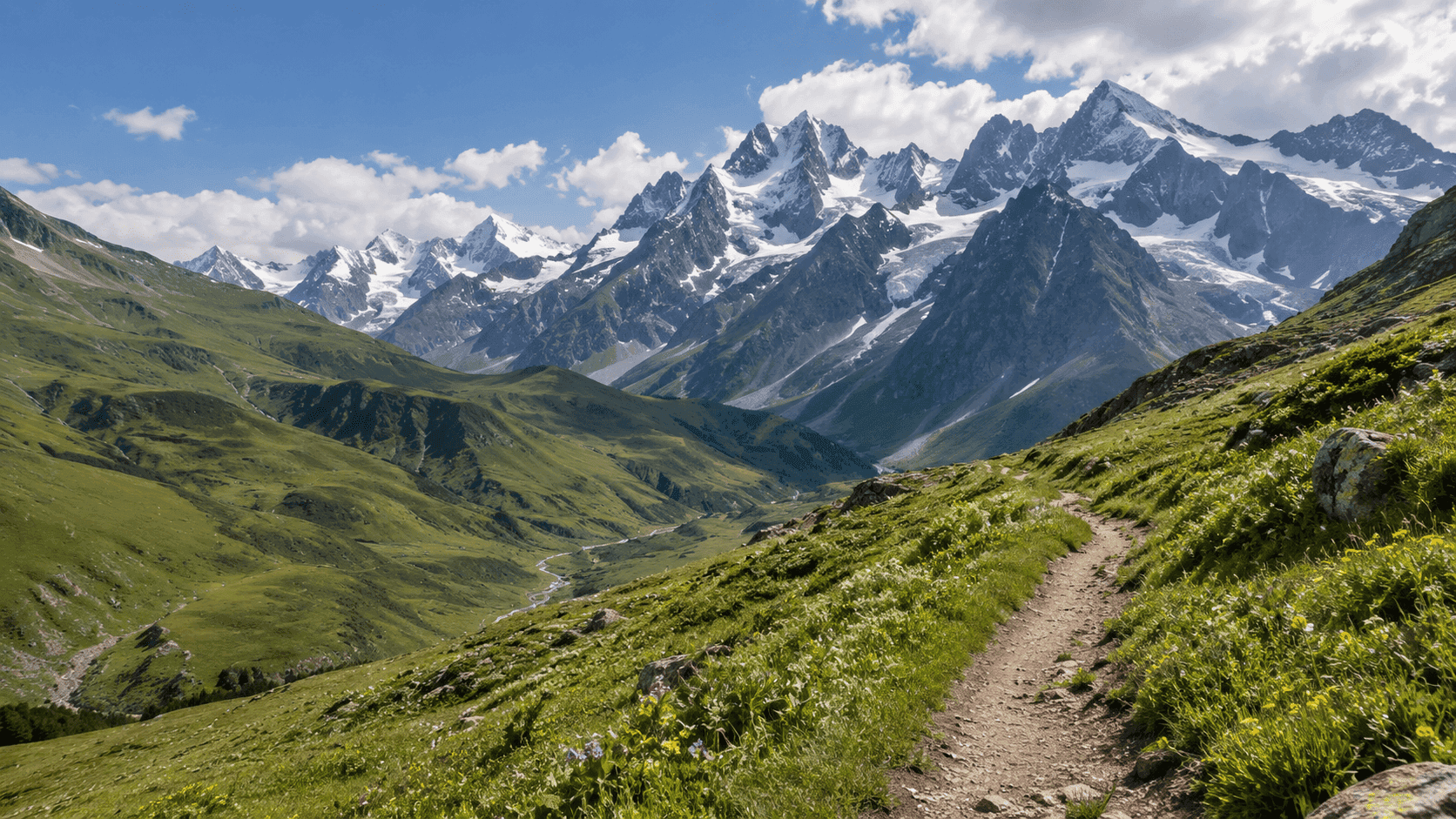
Top 5 Hiking Trails in Georgia That Are Easy to Reach by Car
Top 5 Hiking Trails in Georgia That Are Easy to Reach by Car
Top 5 Hiking Trails in Georgia That Are Easy to Reach by Car
Top 5 Hiking Trails in Georgia That Are Easy to Reach by Car
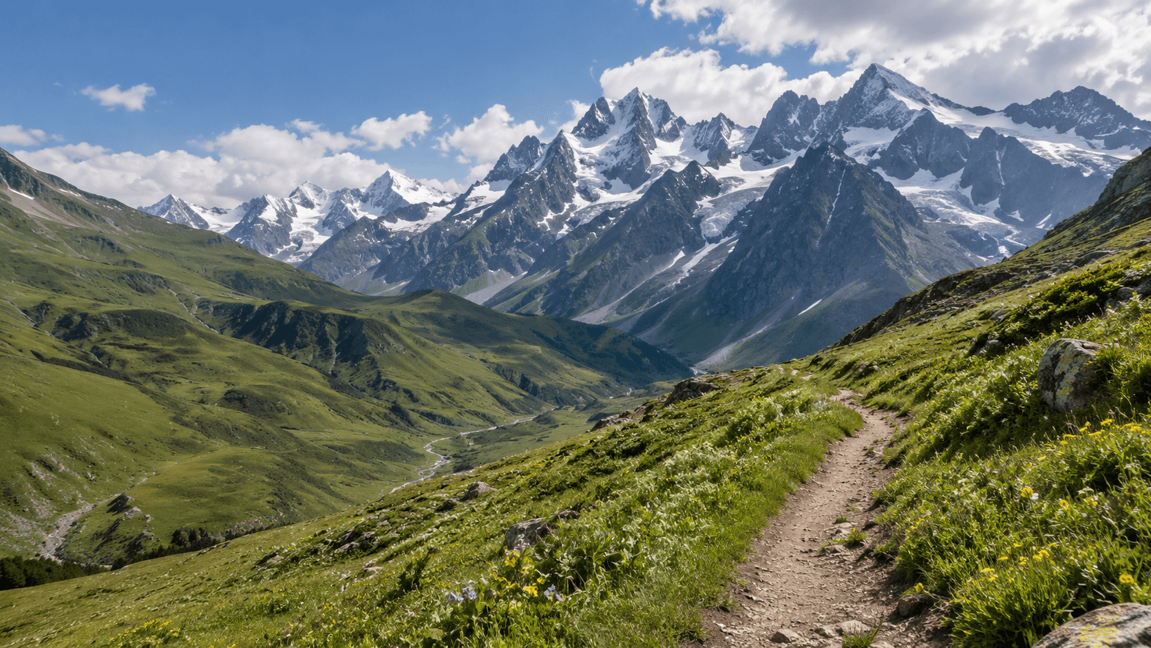
Why Having a Car Makes Hiking in Georgia So Much Easier
In Georgia, getting to the trailhead can sometimes be harder than the hike itself. Many routes begin in small mountain villages where public transport either does not run at all or operates once a day on a timetable that is difficult to rely on.
Where the Problems Usually Start
A typical trip can involve taking a minibus to the nearest regional town, finding a taxi or local driver to continue to the village, and arranging for someone to pick you up again in the evening — all before you have even set foot on the trail.
The return journey can be even more stressful. If your hike takes two hours longer than expected, the driver you arranged may already be gone.
How a Car Changes Your Schedule
With your own car, a day hike looks completely different. You can leave Tbilisi at 6:00 AM, reach the trail by 9:00, hike at your own pace, and return when you are actually finished rather than rushing to catch the last minibus.
It is not just about comfort. In many cases, it is the difference between having enough time for the hike and not being able to do it at all.
A car also gives you somewhere to leave things you do not want to carry all day: extra water, dry clothes, food for the drive back, or additional gear.
How We Chose These Five Routes
These routes were selected using three main criteria:
they work realistically as day trips from Tbilisi, with one exception that we explain separately;
the road to the trailhead is relatively straightforward;
they cover different difficulty levels, from beginner-friendly walks to more demanding mountain hikes.
Two of the routes are best reached in a vehicle with good ground clearance, while three are accessible in a regular sedan.
1. Truso Valley — Mineral Springs and Travertine Terraces
Truso Valley is a high-altitude gorge where the Terek River begins its journey from the glaciers of the Greater Caucasus.
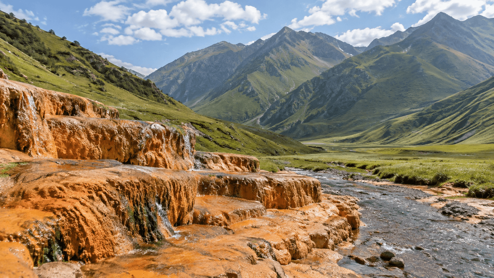
The valley is known for dozens of mineral springs. Over centuries, mineral-rich water has created striking rust-colored travertine terraces that look almost like a frozen waterfall.
The trail itself is one of the easiest in this list. There is very little steep climbing, and most of the valley follows a gentle gradient.
Getting There
Follow the Georgian Military Highway toward Kazbegi. Near the village of Kobi, around 17 km south of Stepantsminda, turn west off the main paved road.
From here, the road becomes unpaved. The first section, roughly two kilometers long, runs along a narrow gorge above the Terek River. The road is tight in places, with several pull-outs for passing vehicles and photo stops. Small waterfalls descend from the cliffs along the way.
Where to Leave the Car
The simplest approach is to drive as far as your vehicle comfortably allows, park, and continue on foot.
There is little reason to take a standard rental sedan deep into the valley. If you are short on time or do not want to walk the full distance, local drivers near the entrance sometimes offer transfers in higher-clearance vehicles to the travertines or farther into the valley.
Border Zone: How Far Can You Go?
This is an important detail many travelers only discover after arriving.
The first roughly 14 km of the valley are accessible without a special permit. Farther ahead, near the village of Desi, there is a border checkpoint because the area approaches South Ossetia.
Carry your passport with you.
The main sights — travertines, mineral springs, abandoned villages, and old towers — are all within the accessible section, so this does not affect a typical day hike.
Best Season and Car Choice
The best time to visit is summer and early autumn.
In winter, access toward Kobi depends heavily on conditions at the Cross Pass, which may temporarily close during heavy snowfall.
Car: A sedan is enough to reach the turn-off from the main highway, but once you continue onto the dirt road, extra ground clearance makes the drive considerably safer and more comfortable. A crossover is the most practical choice.
2. Juta — Sno Valley Beneath the Chaukhi Massif
Juta is a high-altitude village at around 2,200 meters and one of the most scenic trailheads in Georgia.
Rising directly above the valley is the dramatic Chaukhi Massif — a jagged wall of rock that dominates almost every photograph taken here.
For a day hike, Juta is one of the best options in the Kazbegi region. A relatively gentle trail leads up the Sno Valley, while a small glacial lake nearby makes a good destination for a shorter hike suitable even for less experienced walkers.
Getting There
Take the Georgian Military Highway toward Stepantsminda. Before reaching town, turn toward the village of Sno and continue for roughly 12 km on an unpaved mountain road to Juta.
The drive from Stepantsminda to Juta takes around an hour.
This dirt road is the main challenge of the trip. It is passable, but rough, with stones, potholes, and washed-out sections. After heavy rain, conditions become noticeably worse.
This is also where plans often change for travelers who arrive in a low-clearance sedan.
The Hike
From the parking area in Juta, the trail climbs gradually through the valley without particularly steep sections.
For a shorter hike to the lake and back, allow around 3–5 hours including breaks.
If you want a more demanding route, you can continue toward Chaukhi Pass. From Juta to the pass is roughly 8 km one way with around 1,100 meters of elevation gain.
Best Season and Car Choice
The usual season is from May to October. Outside these months, road conditions to Juta can become unpredictable.
Car: Good ground clearance is strongly recommended. A crossover or SUV is the sensible choice for the final 12 km of rough road.
3. Abudelauri Lakes — Three Colored Alpine Lakes in Khevsureti
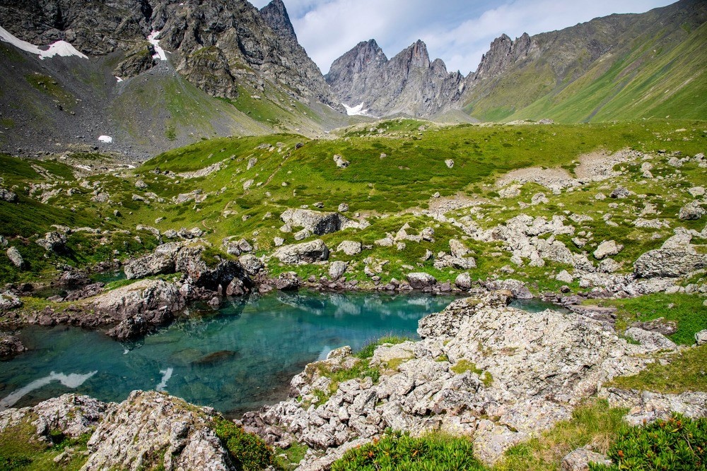
The White, Blue, and Green Lakes sit at roughly 2,600–2,800 meters above sea level, each with its own distinctive color.
This is arguably the most beautiful hike on the list — and also one of the most demanding.
Why This Is Not a Day Trip from Juta
There is a common misconception online that the Abudelauri Lakes are an easy extension of a visit to Juta.
They are not.
From the parking area in Juta, the lakes are around 12 km away in one direction and can take 6–7 hours to reach. A full route via the mountain passes can reach approximately 30 km and require 17–18 hours of hiking, which is why it is usually completed over two days.
Leaving Tbilisi in the morning, hiking from Juta to the lakes, and returning to the city the same evening is not realistic.
Approaching from Roshka
The shorter option is to start from the village of Roshka in Khevsureti.
To get there, take the road toward Shatili, turning off near the Zhinvali Reservoir area and continuing on mountain roads toward the village.
From Roshka, the lakes are significantly closer than from Juta. The trail begins fairly gently before climbing more steeply, with the Green Lake usually reached first.
Overnight Stay and the Pass Route
The classic itinerary takes two days: hike up to the lakes, camp overnight, and descend the following day.
Another option is a point-to-point trek from Juta to Roshka via Chaukhi Pass at 3,338 meters. It is considerably more demanding but allows you to see both the Chaukhi Massif and the Abudelauri Lakes on the same route.
Best Season and Car Choice
The hiking window is short: approximately late June to early September. Snow can still remain around the lakes even at the end of June.
Car: The final road to Roshka is unpaved, so good ground clearance is important. If you leave the car in the village for two days, park near occupied houses and check with local residents where it is best to leave it.
4. Birtvisi — A Rocky Canyon One Hour from Tbilisi
Birtvisi is the closest route on this list and one of the most underrated hiking destinations near Tbilisi.
It is a maze of limestone cliffs in the Algeti River area, with rock towers, narrow passages, and the ruins of a medieval fortress hidden high above the canyon.
The scenery feels completely different from the classic Caucasus hiking landscape. Instead of alpine meadows, Birtvisi feels more like a mix of canyon, rock labyrinth, and abandoned fortress.
Getting There
Birtvisi is around 50 km southwest of Tbilisi in Tetritskaro Municipality, north of the Algeti Reservoir.
The drive takes approximately one hour.
There are two main approaches. The most common southern entrance is from the village of Tbisi. A second, less frequently used approach comes from the village of Amlevi to the northwest.
Hiking and Scrambling Sections
This is where route descriptions can be misleading.
The difficulty varies considerably depending on how far you go. The upper and lower parts are relatively straightforward, while some central sections involve scrambling over rocks and may require ropes.
Walking through the lower canyon is accessible to most hikers. Reaching the fortress and crossing some of the more technical rocky sections is a different matter.
If you are traveling with children or have little scrambling experience, stick to the easier sections and avoid pushing higher.
Allow 6–8 hours for the full route including the climb to the fortress.
Best Season and Car Choice
Spring and autumn are usually best, especially in dry weather. With less foliage, views are more open, and dry rock is much safer underfoot.
Summer can be very hot. Winter hiking is possible, but slippery rock makes the route more difficult.
Car: The main road is paved, so a sedan is enough. The final approach to the village is short and normally manageable.
5. Borjomi-Kharagauli — Likani to Kvabiskhevi
This is the most organized hiking destination on the list.
Borjomi-Kharagauli National Park is one of the largest protected areas in the region, with an extensive network of marked trails, shelters, designated picnic spots, and official fire areas.
For a day hike, the route from Likani to Kvabiskhevi is a convenient option. It does not require an overnight stay, the terrain is relatively gentle, and it works well for families with children.
Getting There and Parking
Borjomi is around 160 km from Tbilisi and usually takes roughly two hours to reach on good roads.
Drive toward Khashuri and continue from there toward Borjomi.
Parking near the visitor center is the most convenient option, as much of the park's route logistics are organized from there.
Registration Is Required
This is an important detail that many visitors overlook.
Before entering the trail network, hikers are required to register at the Borjomi or Kharagauli visitor center. The rule is primarily for safety so that park rangers know who is on the trails and where they are planning to go.
Entry to the park itself is free.
At the visitor center, you can also ask about current trail conditions, maps, and ranger services.
Best Season and Car Choice
The park operates year-round, including winter activities such as snowshoeing.
Caucasian rhododendrons usually bloom around May and June.
Car: The road is paved all the way, so a sedan is more than enough. This is the only route on the list where the car is useful mainly for getting there rather than for handling difficult road conditions.
Hiking Routes Compared
Route | From Tbilisi | Time on Trail | Difficulty | Recommended Car | Best Season |
Truso Valley | ~150 km | 4–6 hrs | Easy | Crossover | Summer–early autumn |
Juta | ~150 km | 3–5 hrs | Easy–moderate | Crossover / SUV | May–October |
Abudelauri Lakes | ~110 km to Roshka | 2 days | Difficult | SUV | Late June–early September |
Birtvisi | ~50 km | 3–8 hrs | Easy to difficult | Sedan | Spring, autumn |
Borjomi-Kharagauli | ~160 km | 5–7 hrs | Moderate | Sedan | Year-round |
What Kind of Car Do You Need for Hiking Trips in Georgia?
Where a sedan is enough.
For Birtvisi and Borjomi-Kharagauli, the access roads are mostly paved. If these are the only hikes on your itinerary, there is little reason to pay extra for a larger vehicle.
Where ground clearance matters.
Truso Valley, Juta, and Roshka all involve final sections on unpaved roads with stones, ruts, and uneven surfaces.
Here, ground clearance can matter more than four-wheel drive itself. Damage to the underside of a rental car can be expensive, and rental insurance does not always cover this type of incident.
What to check before leaving.
Make sure the car has a spare tire and the tools needed to change it. Check tire condition and fuel level, as mountain villages may not have filling stations nearby.
It is also worth asking the rental company whether driving on unpaved roads is allowed under the rental agreement, as conditions vary between providers.
For more details on where four-wheel drive is actually useful in Georgia, see our car rental rules guide.
Safety and Preparation
Weather.
Mountain weather can change within an hour. Check the forecast for the nearest village rather than Tbilisi, and carry a rain jacket even if the morning is clear.
Mobile coverage.
Signal often disappears in valleys and gorges. Download an offline map and tell someone where you are going and when you expect to return.
Food and water.
Most of these routes have no cafés or shops along the way. In places such as Truso Valley, there may be nowhere to buy anything at all, so carry everything you need.
Where to leave the car.
If possible, park near occupied houses in a village rather than on an isolated roadside. Mountain villages in Georgia are generally quiet, but there is no reason to leave valuables visible inside the car.
If the hike is not going well.
Turning back is always an option. Many mountain accidents happen because hikers continue despite deteriorating weather, fading daylight, or fatigue.
Common Mistakes
Underestimating hiking time.
Times listed in route descriptions usually refer to actual walking time and may not include lunch, photography, or long breaks. A useful rule is to add around 50% to the basic estimate.
Starting too late.
Even in summer, a long descent can take more time than expected. Starting a mountain route after midday is rarely a good idea.
Trying to do the Abudelauri Lakes as a day trip.
This is one of the most common planning mistakes and one worth avoiding.
Taking a sedan onto rough mountain roads “just to see how far it gets.”
Testing the limits of a rental car can become expensive very quickly.
Forgetting your passport.
This is particularly important in Truso Valley because of the nearby border zone.
Final Thoughts
These five routes cover almost the full range of hiking experiences in Georgia — from an easy canyon walk just an hour from Tbilisi to a two-day trek to high-altitude alpine lakes.
They all have one thing in common: reaching the trailhead is much easier when you have your own car.
If you are planning only one or two easier routes, a regular passenger car is enough. If Truso Valley, Juta, or Roshka are on your itinerary, choose a crossover or SUV with good ground clearance.
In those places, the right vehicle is not simply about comfort. It can determine whether you reach the start of the trail at all.
Browse cars for mountain trips →
Top 5 Hiking Trails in Georgia That Are Easy to Reach by Car
Why Having a Car Makes Hiking in Georgia So Much Easier
In Georgia, getting to the trailhead can sometimes be harder than the hike itself. Many routes begin in small mountain villages where public transport either does not run at all or operates once a day on a timetable that is difficult to rely on.
Where the Problems Usually Start
A typical trip can involve taking a minibus to the nearest regional town, finding a taxi or local driver to continue to the village, and arranging for someone to pick you up again in the evening — all before you have even set foot on the trail.
The return journey can be even more stressful. If your hike takes two hours longer than expected, the driver you arranged may already be gone.
How a Car Changes Your Schedule
With your own car, a day hike looks completely different. You can leave Tbilisi at 6:00 AM, reach the trail by 9:00, hike at your own pace, and return when you are actually finished rather than rushing to catch the last minibus.
It is not just about comfort. In many cases, it is the difference between having enough time for the hike and not being able to do it at all.
A car also gives you somewhere to leave things you do not want to carry all day: extra water, dry clothes, food for the drive back, or additional gear.
How We Chose These Five Routes
These routes were selected using three main criteria:
they work realistically as day trips from Tbilisi, with one exception that we explain separately;
the road to the trailhead is relatively straightforward;
they cover different difficulty levels, from beginner-friendly walks to more demanding mountain hikes.
Two of the routes are best reached in a vehicle with good ground clearance, while three are accessible in a regular sedan.
1. Truso Valley — Mineral Springs and Travertine Terraces
Truso Valley is a high-altitude gorge where the Terek River begins its journey from the glaciers of the Greater Caucasus.
The valley is known for dozens of mineral springs. Over centuries, mineral-rich water has created striking rust-colored travertine terraces that look almost like a frozen waterfall.
The trail itself is one of the easiest in this list. There is very little steep climbing, and most of the valley follows a gentle gradient.
Getting There
Follow the Georgian Military Highway toward Kazbegi. Near the village of Kobi, around 17 km south of Stepantsminda, turn west off the main paved road.
From here, the road becomes unpaved. The first section, roughly two kilometers long, runs along a narrow gorge above the Terek River. The road is tight in places, with several pull-outs for passing vehicles and photo stops. Small waterfalls descend from the cliffs along the way.
Where to Leave the Car
The simplest approach is to drive as far as your vehicle comfortably allows, park, and continue on foot.
There is little reason to take a standard rental sedan deep into the valley. If you are short on time or do not want to walk the full distance, local drivers near the entrance sometimes offer transfers in higher-clearance vehicles to the travertines or farther into the valley.
Border Zone: How Far Can You Go?
This is an important detail many travelers only discover after arriving.
The first roughly 14 km of the valley are accessible without a special permit. Farther ahead, near the village of Desi, there is a border checkpoint because the area approaches South Ossetia.
Carry your passport with you.
The main sights — travertines, mineral springs, abandoned villages, and old towers — are all within the accessible section, so this does not affect a typical day hike.
Best Season and Car Choice
The best time to visit is summer and early autumn.
In winter, access toward Kobi depends heavily on conditions at the Cross Pass, which may temporarily close during heavy snowfall.
Car: A sedan is enough to reach the turn-off from the main highway, but once you continue onto the dirt road, extra ground clearance makes the drive considerably safer and more comfortable. A crossover is the most practical choice.
2. Juta — Sno Valley Beneath the Chaukhi Massif
Juta is a high-altitude village at around 2,200 meters and one of the most scenic trailheads in Georgia.
Rising directly above the valley is the dramatic Chaukhi Massif — a jagged wall of rock that dominates almost every photograph taken here.
For a day hike, Juta is one of the best options in the Kazbegi region. A relatively gentle trail leads up the Sno Valley, while a small glacial lake nearby makes a good destination for a shorter hike suitable even for less experienced walkers.
Getting There
Take the Georgian Military Highway toward Stepantsminda. Before reaching town, turn toward the village of Sno and continue for roughly 12 km on an unpaved mountain road to Juta.
The drive from Stepantsminda to Juta takes around an hour.
This dirt road is the main challenge of the trip. It is passable, but rough, with stones, potholes, and washed-out sections. After heavy rain, conditions become noticeably worse.
This is also where plans often change for travelers who arrive in a low-clearance sedan.
The Hike
From the parking area in Juta, the trail climbs gradually through the valley without particularly steep sections.
For a shorter hike to the lake and back, allow around 3–5 hours including breaks.
If you want a more demanding route, you can continue toward Chaukhi Pass. From Juta to the pass is roughly 8 km one way with around 1,100 meters of elevation gain.
Best Season and Car Choice
The usual season is from May to October. Outside these months, road conditions to Juta can become unpredictable.
Car: Good ground clearance is strongly recommended. A crossover or SUV is the sensible choice for the final 12 km of rough road.
3. Abudelauri Lakes — Three Colored Alpine Lakes in Khevsureti
The White, Blue, and Green Lakes sit at roughly 2,600–2,800 meters above sea level, each with its own distinctive color.
This is arguably the most beautiful hike on the list — and also one of the most demanding.
Why This Is Not a Day Trip from Juta
There is a common misconception online that the Abudelauri Lakes are an easy extension of a visit to Juta.
They are not.
From the parking area in Juta, the lakes are around 12 km away in one direction and can take 6–7 hours to reach. A full route via the mountain passes can reach approximately 30 km and require 17–18 hours of hiking, which is why it is usually completed over two days.
Leaving Tbilisi in the morning, hiking from Juta to the lakes, and returning to the city the same evening is not realistic.
Approaching from Roshka
The shorter option is to start from the village of Roshka in Khevsureti.
To get there, take the road toward Shatili, turning off near the Zhinvali Reservoir area and continuing on mountain roads toward the village.
From Roshka, the lakes are significantly closer than from Juta. The trail begins fairly gently before climbing more steeply, with the Green Lake usually reached first.
Overnight Stay and the Pass Route
The classic itinerary takes two days: hike up to the lakes, camp overnight, and descend the following day.
Another option is a point-to-point trek from Juta to Roshka via Chaukhi Pass at 3,338 meters. It is considerably more demanding but allows you to see both the Chaukhi Massif and the Abudelauri Lakes on the same route.
Best Season and Car Choice
The hiking window is short: approximately late June to early September. Snow can still remain around the lakes even at the end of June.
Car: The final road to Roshka is unpaved, so good ground clearance is important. If you leave the car in the village for two days, park near occupied houses and check with local residents where it is best to leave it.
4. Birtvisi — A Rocky Canyon One Hour from Tbilisi
Birtvisi is the closest route on this list and one of the most underrated hiking destinations near Tbilisi.
It is a maze of limestone cliffs in the Algeti River area, with rock towers, narrow passages, and the ruins of a medieval fortress hidden high above the canyon.
The scenery feels completely different from the classic Caucasus hiking landscape. Instead of alpine meadows, Birtvisi feels more like a mix of canyon, rock labyrinth, and abandoned fortress.
Getting There
Birtvisi is around 50 km southwest of Tbilisi in Tetritskaro Municipality, north of the Algeti Reservoir.
The drive takes approximately one hour.
There are two main approaches. The most common southern entrance is from the village of Tbisi. A second, less frequently used approach comes from the village of Amlevi to the northwest.
Hiking and Scrambling Sections
This is where route descriptions can be misleading.
The difficulty varies considerably depending on how far you go. The upper and lower parts are relatively straightforward, while some central sections involve scrambling over rocks and may require ropes.
Walking through the lower canyon is accessible to most hikers. Reaching the fortress and crossing some of the more technical rocky sections is a different matter.
If you are traveling with children or have little scrambling experience, stick to the easier sections and avoid pushing higher.
Allow 6–8 hours for the full route including the climb to the fortress.
Best Season and Car Choice
Spring and autumn are usually best, especially in dry weather. With less foliage, views are more open, and dry rock is much safer underfoot.
Summer can be very hot. Winter hiking is possible, but slippery rock makes the route more difficult.
Car: The main road is paved, so a sedan is enough. The final approach to the village is short and normally manageable.
5. Borjomi-Kharagauli — Likani to Kvabiskhevi
This is the most organized hiking destination on the list.
Borjomi-Kharagauli National Park is one of the largest protected areas in the region, with an extensive network of marked trails, shelters, designated picnic spots, and official fire areas.
For a day hike, the route from Likani to Kvabiskhevi is a convenient option. It does not require an overnight stay, the terrain is relatively gentle, and it works well for families with children.
Getting There and Parking
Borjomi is around 160 km from Tbilisi and usually takes roughly two hours to reach on good roads.
Drive toward Khashuri and continue from there toward Borjomi.
Parking near the visitor center is the most convenient option, as much of the park's route logistics are organized from there.
Registration Is Required
This is an important detail that many visitors overlook.
Before entering the trail network, hikers are required to register at the Borjomi or Kharagauli visitor center. The rule is primarily for safety so that park rangers know who is on the trails and where they are planning to go.
Entry to the park itself is free.
At the visitor center, you can also ask about current trail conditions, maps, and ranger services.
Best Season and Car Choice
The park operates year-round, including winter activities such as snowshoeing.
Caucasian rhododendrons usually bloom around May and June.
Car: The road is paved all the way, so a sedan is more than enough. This is the only route on the list where the car is useful mainly for getting there rather than for handling difficult road conditions.
Hiking Routes Compared
Route | From Tbilisi | Time on Trail | Difficulty | Recommended Car | Best Season |
Truso Valley | ~150 km | 4–6 hrs | Easy | Crossover | Summer–early autumn |
Juta | ~150 km | 3–5 hrs | Easy–moderate | Crossover / SUV | May–October |
Abudelauri Lakes | ~110 km to Roshka | 2 days | Difficult | SUV | Late June–early September |
Birtvisi | ~50 km | 3–8 hrs | Easy to difficult | Sedan | Spring, autumn |
Borjomi-Kharagauli | ~160 km | 5–7 hrs | Moderate | Sedan | Year-round |
What Kind of Car Do You Need for Hiking Trips in Georgia?
Where a sedan is enough.
For Birtvisi and Borjomi-Kharagauli, the access roads are mostly paved. If these are the only hikes on your itinerary, there is little reason to pay extra for a larger vehicle.
Where ground clearance matters.
Truso Valley, Juta, and Roshka all involve final sections on unpaved roads with stones, ruts, and uneven surfaces.
Here, ground clearance can matter more than four-wheel drive itself. Damage to the underside of a rental car can be expensive, and rental insurance does not always cover this type of incident.
What to check before leaving.
Make sure the car has a spare tire and the tools needed to change it. Check tire condition and fuel level, as mountain villages may not have filling stations nearby.
It is also worth asking the rental company whether driving on unpaved roads is allowed under the rental agreement, as conditions vary between providers.
For more details on where four-wheel drive is actually useful in Georgia, see our car rental rules guide.
Safety and Preparation
Weather.
Mountain weather can change within an hour. Check the forecast for the nearest village rather than Tbilisi, and carry a rain jacket even if the morning is clear.
Mobile coverage.
Signal often disappears in valleys and gorges. Download an offline map and tell someone where you are going and when you expect to return.
Food and water.
Most of these routes have no cafés or shops along the way. In places such as Truso Valley, there may be nowhere to buy anything at all, so carry everything you need.
Where to leave the car.
If possible, park near occupied houses in a village rather than on an isolated roadside. Mountain villages in Georgia are generally quiet, but there is no reason to leave valuables visible inside the car.
If the hike is not going well.
Turning back is always an option. Many mountain accidents happen because hikers continue despite deteriorating weather, fading daylight, or fatigue.
Common Mistakes
Underestimating hiking time.
Times listed in route descriptions usually refer to actual walking time and may not include lunch, photography, or long breaks. A useful rule is to add around 50% to the basic estimate.
Starting too late.
Even in summer, a long descent can take more time than expected. Starting a mountain route after midday is rarely a good idea.
Trying to do the Abudelauri Lakes as a day trip.
This is one of the most common planning mistakes and one worth avoiding.
Taking a sedan onto rough mountain roads “just to see how far it gets.”
Testing the limits of a rental car can become expensive very quickly.
Forgetting your passport.
This is particularly important in Truso Valley because of the nearby border zone.
Final Thoughts
These five routes cover almost the full range of hiking experiences in Georgia — from an easy canyon walk just an hour from Tbilisi to a two-day trek to high-altitude alpine lakes.
They all have one thing in common: reaching the trailhead is much easier when you have your own car.
If you are planning only one or two easier routes, a regular passenger car is enough. If Truso Valley, Juta, or Roshka are on your itinerary, choose a crossover or SUV with good ground clearance.
In those places, the right vehicle is not simply about comfort. It can determine whether you reach the start of the trail at all.
Browse cars for mountain trips →